Sailing the Dodecanese from Kos: Winds, Anchorages and Island-Hopping Routes North
Updated
A detailed sailing guide to the northern Dodecanese, covering the route from Kos north through Kalymnos, Leros, and Lipsi to the bays of Makronisi — with advice on navigating the meltemi, choosing east or west coasts, and the best anchorages along the way.
On this page

The Dodecanese archipelago stretches along the eastern edge of the Aegean Sea, tucked close to the Turkish coastline and forming one of Greece's most rewarding yet underappreciated sailing regions. Starting from the bustling port of Kos and heading north, sailors enter a world defined by dramatic volcanic rock formations, Byzantine monasteries perched on hilltops, and some of the clearest anchorages in the Mediterranean. This is not the Cyclades. The crowds are thinner, the winds behave differently, and the sense of discovery — particularly when dropping anchor in a deserted bay with Turkey's mountains rising from the water just miles away — is something that stays with you long after the ropes are coiled.]
What Makes the Dodecanese Distinct
Where the Cyclades are defined by stark white cubist architecture, packed anchorages, and the relentless social energy of high season, the Dodecanese offer a quieter rhythm. The islands here are more spread out, the distances between them more substantial, and the sailing itself more purposeful. You are rarely crowded at anchor, rarely queueing for a berth, and rarely fighting the same route as fifty other charter boats.
The proximity to Turkey is one of the defining characteristics of this stretch. Many anchorages sit within easy sight of the Turkish mainland, and the cultural layering of the islands reflects this history — Crusader castles, Ottoman fountains, Greek Orthodox churches, and art deco Italian architecture from the period of Italian administration all coexist on the same waterfront. Kos itself is a vivid example, where a medieval castle overlooks a Roman agora a short walk from a bustling Turkish market neighborhood.
The northern Dodecanese — from Kos up through Kalymnos, Leros, Lipsi, and the bays around Makronisi — forms a natural sailing circuit that can be completed comfortably in five to seven days. The route is flexible enough to be adjusted based on wind direction and energy levels, with the choice of east or west sides of the islands depending on whether the meltemi is running hard or sitting light.
Sailing Conditions and the Meltemi
The dominant wind in this region from June through September is the meltemi, the dry northerly that sweeps down from the Aegean with varying intensity. In the Dodecanese, the meltemi behaves somewhat differently than in the Cyclades, where it can blow an unrelenting Force 5 to 6 for days at a time, turning passages into endurance tests. Here in the eastern Aegean, the meltemi tends to be more moderate, typically sitting in the Force 3 to 4 range, though it can build to Force 5 or beyond during its peak periods in July and August. It is also more variable in direction, influenced by the Turkish mountains to the east and the topography of the islands themselves.
The classic meltemi pattern sees the wind arrive by mid-morning, build through the afternoon, and ease by sunset. Morning passages are often glassy calm or lightly breezed, which is worth building into your planning. The wind tends to accelerate in the channels between islands, where the Venturi effect can push you above the ambient wind strength, so passages between Kos and Kalymnos or through the straits near Leros deserve respect.
The choice between the east and west coasts of each island is central to Dodecanese route planning. When the meltemi is running at Force 4 or above, the east coasts — facing Turkey — offer shelter and calmer conditions, with anchorages tucked behind headlands providing reasonable protection. The west coasts are exposed to the northerly and can be uncomfortable in a blow. In lighter conditions or with a southerly wind (less common in summer but not unknown), the west sides open up and offer their own rewards, including more dramatic scenery and fewer boats at anchor.
Who This Route Suits
This route is accessible to competent novice sailors who have completed a basic coastal skipper qualification, but it will be most enjoyed by those with some Aegean experience. The distances involved — typically fifteen to twenty-five nautical miles between stops — are not intimidating, but the afternoon meltemi in the channels demands confidence in sail handling. Bareboat charterers on their second or third Aegean trip will find this route a step up from the more sheltered Saronic Gulf, but well within reach.
For experienced sailors, the region rewards deeper exploration. The less-visited anchorages on the east coasts, the crossing of the channel between Kalymnos and Leros at dawn in flat water, and the extraordinary remoteness of some Lipsi bays make this territory that repays return visits. This is also good cruising ground for those who prefer anchoring out over marina life — the majority of nights on this route can be spent on the hook, with marina stops reserved for restocking and a proper evening ashore.
Suggested 7-Day Itinerary: Kos to Makronisi and Back
This itinerary runs north from Kos, using the meltemi to advantage for the outward leg and returning south either down the same coast or switching sides depending on conditions. Total distances are modest — around ninety to one hundred nautical miles each way — making it achievable for a mixed-ability crew without exhausting anyone.
Day 1: Kos Town to Mastihari or Kamari Bay
Kos Marina is the natural starting point, well-equipped with water, fuel, and a full provisioning supermarket within walking distance of the pontoons. Before leaving, take a morning to walk the waterfront and visit the plane tree under which Hippocrates is said to have taught — it sets the tone for an island that has been receiving visitors for a very long time. Paperwork for charter boats is handled efficiently at the port authority office near the marina entrance.
The first day's sail is deliberately short, designed to shake out the crew and the rig without committing to a long passage. Mastihari, on the northwest coast of Kos, is around ten nautical miles from the marina and offers a small harbor with a few laid berths or, better, anchor off in reasonable shelter in settled northerly conditions. Kamari Bay on the southwestern tip is another option, a quieter anchorage below the ancient ruins of Agios Stefanos and the islet of Kastri. The bay is wide and sandy, the holding is good in three to five meters over sand, and there is a taverna on the beach that has been serving grilled fish and cold Mythos to arriving sailors for decades. Swim before dinner. This is what it is all about.
Day 2: Mastihari to Vathy, Kalymnos
The crossing from Kos to Kalymnos is one of the signature passages of this route — around twelve nautical miles across the Kos Strait, with the meltemi typically building by mid-morning. Leave early to make the most of the calm, or embrace the afternoon blow if your crew is comfortable with a brisk reach. The channel can funnel the wind to Force 5, so reef early if in doubt.
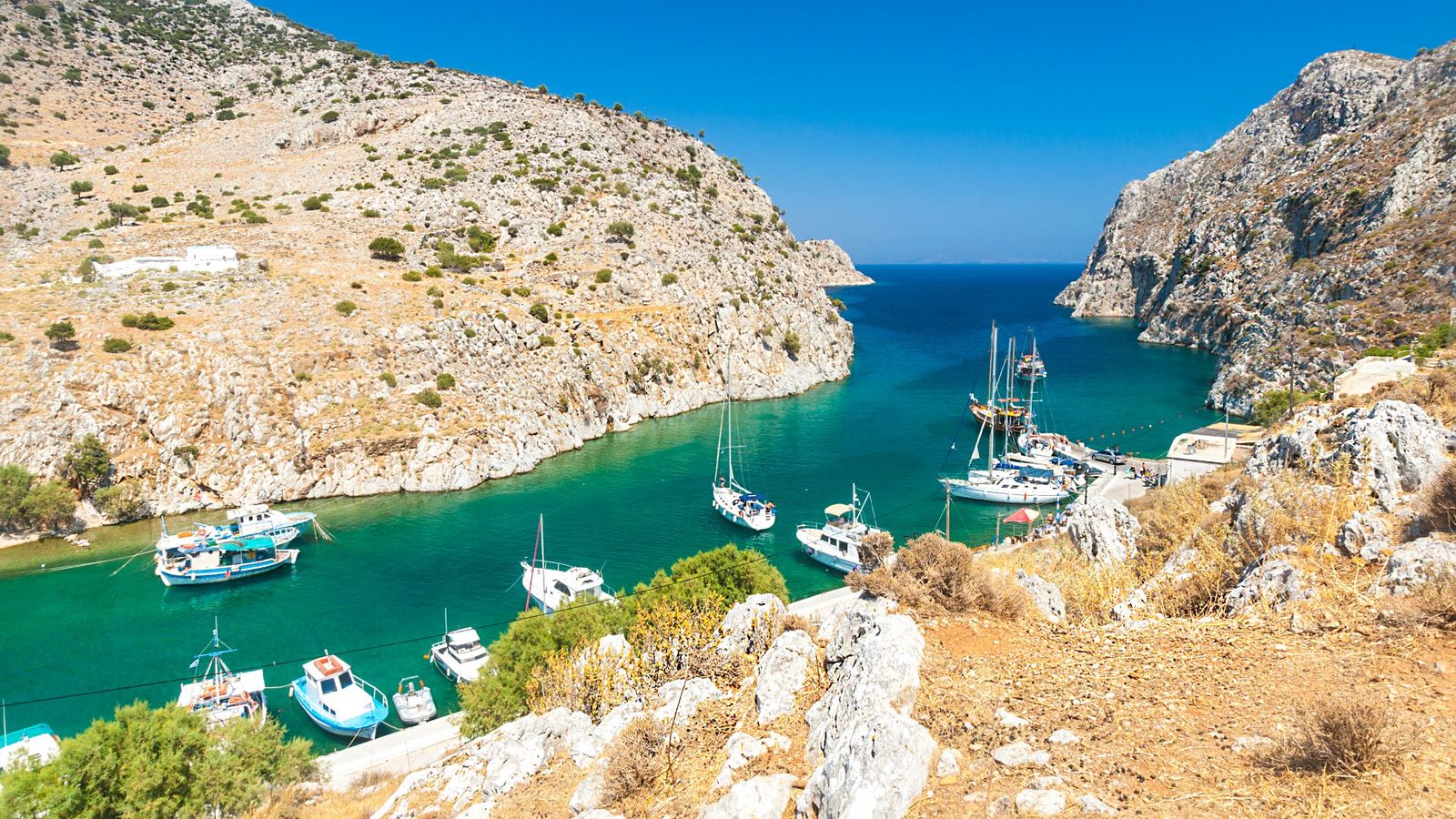
Kalymnos is the sponge-diving island, and the culture here is distinct from anywhere else in Greece. The island was the center of Mediterranean sponge diving for over a century, and the tradition still shapes the local identity even as the industry has diminished. The most rewarding anchorage on Kalymnos is Vathy, a long fjord-like inlet on the eastern coast that cuts deep into the limestone mountains. The approach is dramatic — the entrance appears almost closed until you are upon it, then opens into a serene channel no more than two hundred meters wide in places. Anchor at the head of the fjord in five to eight meters over mud and sand, with excellent holding. There is a small village at the end, with a couple of tavernas and a bakery. The quiet here is remarkable. At night, with the mountains pressing in on both sides and the stars overhead, Vathy feels entirely removed from the world.
Day 3: Vathy to Leros (Lakki or Pandeli)
The passage from Kalymnos to Leros covers around fifteen nautical miles and is best made in the morning before the meltemi builds. The route passes between Kalymnos and the small island of Telendos — a detached volcanic plug that makes for a striking sight — before opening into the channel north of Kalymnos. Keep an eye on the wind in this channel as it can strengthen considerably.
Leros is one of the most architecturally interesting islands in the Dodecanese, its waterfront towns largely built during the Italian period of the 1930s, giving the harbor at Lakki an incongruous art deco grandeur that sits oddly but beautifully on a Greek island. Lakki is a deep, well-sheltered port — it was used as a major naval base under the Italians — and is one of the few places on this route where you will find a proper marina berth if you want shore power and a connection to the town. However, for atmosphere, the anchorage off Pandeli on the northeastern coast is far more appealing. Anchor below the medieval castle in five to eight meters, with the village curving around the bay and the castle walls illuminated at dusk. A short walk uphill reaches the castle for an exceptional view over the surrounding waters toward Lipsi.
Day 4: Leros to Lipsi
Lipsi is a small island — population around eight hundred — that offers something increasingly rare in the Aegean: genuine tranquility without isolation. The distance from Leros is only around seven nautical miles, making this an easy half-day passage. Lipsi village sits around the only real harbor, with a handful of laid berths on the town quay or anchoring space in the bay. The village is compact, clean, and genuinely friendly toward visiting sailors — this is an island that depends on yachting tourism but has not been overwhelmed by it.
There are several smaller bays around the island worth exploring by dinghy or kayak. Katsadia Beach on the south coast is particularly fine, a crescent of sand backed by low pines, accessible by dinghy or a short walk from the village. Lipsi also produces its own wine — a dry white that is better than it has any right to be for an island this size — and a local liqueur made from wild figs that the taverna owners will press upon you with some insistence. Spend the afternoon here. Take a walk into the interior in the early evening when the light goes golden. Have dinner at one of the three or four waterfront restaurants and watch the fishing boats come in.
Day 5: Lipsi to Makronisi Bays (Northern Turnaround)
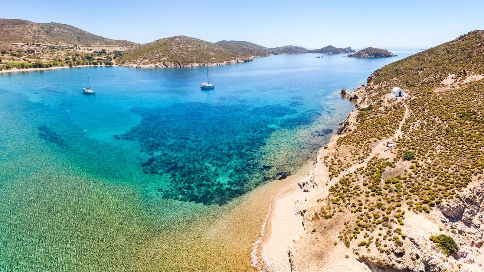
Makronisi — a long, low island north of Lipsi — marks the natural turnaround point for this route. The bays along its eastern and southern shores offer excellent anchorage in settled meltemi conditions, with clear water over white sand in depths of three to six meters. This is uninhabited territory, a place to spend a full afternoon swimming and reading, with no one else for company except perhaps a passing fishing boat. The island itself is scrubby and unremarkable from a distance, but the water here is exceptional — some of the clearest in the northern Dodecanese.
If the meltemi is running hard from the north, approach the bays on the southern and eastern sides of Makronisi, where the island provides a natural windbreak. In lighter conditions, the western anchorages are fine. There is no village, no taverna, and no facilities of any kind — this is an anchor-and-swim stop, and should be treated as such. Provision before you leave Lipsi. Spend the night here if conditions are settled; there is something particularly satisfying about an overnight anchorage on an uninhabited island, with the lights of Patmos visible to the north and Lipsi's harbor lights to the south.
Day 6: Return South — Choosing Your Side
The return south from Makronisi is where the route planning becomes most interesting, and where wind reading pays off. In a typical meltemi scenario — northerly Force 3 to 4, building in the afternoon — the return south offers a comfortable downwind or broad reach for the morning passage, covering ground quickly before the wind builds.
The decision between east and west sides comes down to wind strength and what you have already seen. If you came north predominantly on the eastern coasts (the sheltered side), consider returning down the western coasts for contrast, stopping at anchorages you passed on the way up. The western coast of Kalymnos, for example, has several attractive bays — Kantouni and Linaria among them — that are pleasant in light conditions but uncomfortable in a hard meltemi. In Force 3 or below, these make excellent stopovers. In a stronger meltemi, stay on the eastern sides and work your way south in comfort.
A good overnight stop on the return is the anchorage at Myrties on the western coast of Kalymnos, looking directly across a narrow channel to the island of Telendos. This is a small resort village with a waterfront of tavernas, and the view across to Telendos — where you can dinghy over for a sunset drink — is one of the most photogenic in the Dodecanese. Anchor in four to seven meters off the beach, or tie a stern line to a rock if the wind allows.
Day 7: Return to Kos
The final passage back to Kos Town completes the circuit. If you have energy and time, consider stopping at Pserimos — a tiny island between Kalymnos and Kos — for a final morning swim in its single beach bay before closing the loop. The beach at Pserimos is one of the best in the region, a wide crescent of fine sand with exceptional water clarity. There is a small community of permanent residents, a beach taverna, and daily day-trip boats from Kos, so arrive early if you want the beach to yourself. The anchorage is in two to five meters over sand, with generally good holding.
The final run back to Kos Marina takes around two hours in typical conditions. Return the boat, pay the marina fees, and find a table at one of the restaurants on the western waterfront for a final dinner. Order the fresh fish, whichever the waiter recommends, and a carafe of local white wine. You have earned it.
Marina and Mooring Notes
This route is primarily an anchoring route — the majority of nights will be spent on the hook, with marina stops used for reprovisioning and socializing rather than as the default plan. This is worth stating clearly, because the infrastructure for marina berths in the northern Dodecanese is limited compared to more developed cruising grounds.
Kos Marina is the best-equipped facility on the route, with fuel, water, electricity, WiFi, and a chandlery. Book ahead in July and August — it fills up. Lakki on Leros has a functional small port with some laid berths, managed by the port authority. Lipsi's town quay has space for smaller yachts to go stern-to, though it can be exposed in northerly conditions; anchoring in the bay is generally preferable. Everywhere else on this route is anchor-only, which is part of its charm.
When anchoring, carry enough chain to deploy at least four to five times the water depth. Holding is generally good in sand and mud, but some bays have areas of weed over rock that can be problematic. Always dive on your anchor after setting if in any doubt, especially when staying overnight. A stern line to the shore is sometimes worth rigging in narrower bays to reduce swing, and a second anchor kept ready is good practice for less familiar anchorages.
Cost Expectations
The Dodecanese is generally good value by Mediterranean standards, though prices have increased in recent years in line with the broader rise in Greek tourism costs. A rough budget breakdown for a week afloat, based on a crew of four sharing a forty-foot bareboat charter:
Charter boat hire in the forty-foot range runs from around 2,200 euros to 3,500 euros per week depending on season and vessel age, with peak July-August at the higher end. Security deposits typically run 2,000 to 3,000 euros, held by credit card. Fuel costs for this route, assuming motoring out of harbor and in calms, will run fifty to one hundred euros for the week in a typical diesel auxiliary sailboat. Marina fees at Kos are around thirty-five to fifty euros per night for a forty-foot boat. Anchoring is free throughout Greece.
Taverna meals for four, with wine and a full spread of starters and mains, run fifteen to twenty-five euros per person in most of the smaller islands on this route. Provisioning for a week for four people — with some meals aboard and some ashore — typically costs two hundred to three hundred euros at the Kos supermarkets, which are well-stocked and competitively priced. Budget-conscious crews will find the Dodecanese generous; those who want a sundowner ashore every evening and restaurant dinners throughout will find it manageable but not cheap.
Insider Tips
Tip 1 — Watch the Morning Window: The most reliable passage planning tactic in the Dodecanese summer is to leave before 0900. The meltemi is almost always at its lightest in the early morning, often dead calm, giving you a comfortable motoring or light-wind sailing start. By 1100 to 1200 it is usually building, and by 1400 you want to be at anchor or in the channel you want to be in. Plan your longest passages as early starts, not ambitious afternoon sprints.
Tip 2 — The East Coast Default: Unless you have a specific reason to be on the west coast of any island during a strong meltemi, default to the east. The protection offered by even modest headlands on the east-facing coasts of Kalymnos, Leros, and Lipsi makes an enormous difference to comfort and safety. The anchorages are less dramatic visually in some cases, but arriving in a settled bay after a breezy passage is always the right decision. Save the exposed western anchorages for calm mornings and light-wind days.
Tip 3 — Patmos is Worth the Extra Miles: If your charter allows the additional distance, Patmos lies only around eight nautical miles north of Makronisi and is one of the most extraordinary destinations in the Greek islands — the fortified monastery of Saint John the Theologian dominates the skyline, the Chora is immaculate, and the island carries a spiritual gravity that is genuinely moving even for secular visitors. The main harbor at Skala has room to anchor in the bay, and the walk up to the monastery in the early morning, before the day-trip crowds arrive, is unforgettable. If you can push the turnaround point to Patmos, do it.
Final Planning Notes
The best months for this route are May, June, and September. July and August offer reliable wind but can be very hot, and the meltemi is at its most potent — fine for experienced crews but potentially fatiguing for mixed-ability groups over seven days. May and September bring lighter winds, occasional unsettled weather, and far fewer boats at anchor and in harbors. The water is still warm enough for comfortable swimming from mid-May through mid-October.
A current set of Greek nautical charts covering the northern Dodecanese is essential — the Imray G series covers this area well, with the G28 chart particularly useful for the Kos to Leros passage. A VHF radio and a working depth sounder are non-negotiable for this kind of anchoring-focused route. The Greek Coast Guard broadcasts weather forecasts on VHF Channel 16 and working channels — listen at 0600 and 1800 for the Poseidon forecast, which is reliable for the twenty-four to forty-eight hour window.
The Dodecanese is not the most obvious Aegean sailing destination for first-time visitors to Greece, who are often drawn to the Cyclades or the Ionian. That relative obscurity is precisely its advantage. Come here for the space, the silence in the anchorages, the layered history, and the kind of sailing day that ends with the anchor down, the sun dropping behind limestone cliffs, and nothing on the agenda until morning.


